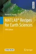
MATLAB® Recipes for Earth Sciences
MATLAB® is used in a wide range of geoscientific applications, e.g. for image processing in remote sensing, for creating and processing digital elevation models, and for analyzing time series. Thi…
- Edition
- 1
- ISBN/ISSN
- 978-3-030-38441-8
- Collation
- XII, 517p.; ill
- Series Title
- Springer Textbooks in Earth Sciences, Geography and Environment
- Call Number
- 005.131 Tra m
Search Result
Found 1 from your keywords: Subject : "quantitative geology"
Query took 0.00136 second(s) to complete

 Computer Science, Information & General Works
  Philosophy & Psychology
  Religion
  Social Sciences
  Language
  Pure Science
  Applied Sciences
  Art & Recreation
  Literature
  History & Geography