ANALISIS COULOMB STRESS CHANGE UNTUK MENGETAHUI ARAH PERSEBARAN STRESS GEMPAB…
Research has been conducted on Coulomb Stress Change to determine the distribution of stress of the Padang earthquake on 30 September 2009 M7.6 and Padang Panjang on 6 March 2007 M6.3 and M6.4. The…
- Edition
- -
- ISBN/ISSN
- -
- Collation
- xi, 39 hlm.; ilus.; 29 cm
- Series Title
- -
- Call Number
- T1430212024

REKAYASA GEMPA UNTUK ANALISIS STRUKTUR & GEOTEKNIK
- Edition
- -
- ISBN/ISSN
- 978-623-359-097-6
- Collation
- xvi, 523 hlm. ; 23 cm
- Series Title
- -
- Call Number
- 551.22 Har r
- Edition
- -
- ISBN/ISSN
- 978-623-359-097-6
- Collation
- xvi, 523 hlm. ; 23 cm
- Series Title
- -
- Call Number
- 551.22 Har r

ANALISIS PENGARUH JENIS TANAH TERHADAP GAYA GESER GEMPA DI KABUPATEN KERINCI …
Secara umum, dalam perencanaan infrastruktur tahan gempa, terdapat beberapa jenis metoda analisis dengan tingkat kesulitan dan akurasi yang bervariasi. Sesuai dengan metoda analisis yang digunakan,…
- Edition
- -
- ISBN/ISSN
- -
- Collation
- 54 hlm.; ill.; tab.; 28 cm.
- Series Title
- -
- Call Number
- T1100512011
PENENTUAN ANOMALI EMISI ULTRA LOW FREQUENCY (ULF) SEBAGAI PREKURSOR GEMPABUMI…
Earthquake precursors using the earth's magnetic data by analyzing Ultra Low Frequency (ULF) emission anomalies is one of the earthquake disaster mitigation efforts. This study uses 11 earthquake d…
- Edition
- -
- ISBN/ISSN
- -
- Collation
- xi, 33 hlm.; ilus.; 29 cm
- Series Title
- -
- Call Number
- T835462022
ANALISA GEMPA BUMI MENGGUNAKAN ANALISIS MORFOTEKTONIK DAERAH MUBA DAN SEKITAR…
The research was conducted in Muba and its surroundings, South Sumatra. This area is included in the back arc basin which is not uncommon for geological disasters, one of which is an earthquake. Th…
- Edition
- -
- ISBN/ISSN
- -
- Collation
- xii, 46 hlm.; ilus.; 29 cm
- Series Title
- -
- Call Number
- T764922022
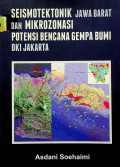
SEISMOTEKTONIK JAWA BARAT DAN MIKROZONASI POTENSI BENCANA GEMPA BUMI DKI JAKARTA
- Edition
- -
- ISBN/ISSN
- 978-602-9105-14-8
- Collation
- ix, 69 hlm. : ilus. ; 25 cm
- Series Title
- -
- Call Number
- 551.22 Soe s
- Edition
- -
- ISBN/ISSN
- 978-602-9105-14-8
- Collation
- ix, 69 hlm. : ilus. ; 25 cm
- Series Title
- -
- Call Number
- 551.22 Soe s
KATALOG GEMPABUMI MERUSAK DI INDONESIA TAHUN 1612 - 2014
- Edition
- -
- ISBN/ISSN
- -
- Collation
- vii, 127 hlm.; 23 cm.
- Series Title
- -
- Call Number
- 551.22 Sup k
- Edition
- -
- ISBN/ISSN
- -
- Collation
- vii, 127 hlm.; 23 cm.
- Series Title
- -
- Call Number
- 551.22 Sup k
RELOKASI GEMPABUMI WILAYAH SUMATERA BARAT TAHUN 2017-2020 MENGGUNAKAN METODE …
The West Sumatra region is an active area of earthquake which is the result of the subduction of the Indo-Australian Plate with the Eurasian Plate. Precise hypocenter analysis is needed to understa…
- Edition
- -
- ISBN/ISSN
- -
- Collation
- x, 60 hlm. : ilus. ; 29 cm
- Series Title
- -
- Call Number
- T580532021

Tsunami: The Underrated Hazard
It is a comprehensive and well illustrated textbook on all aspects of tsunami. I don't think there is any other book on the topic published. As one bookseller said after the Indian Ocean tsunami ev…
- Edition
- 3
- ISBN/ISSN
- 978-3-319-06133-7
- Collation
- xxxi, 222 hlm
- Series Title
- -
- Call Number
- 551.463 7 BRY t

Natural Hazard Zonation of Bihar (India) Using Geoinformatics : A Schematic A…
With increased climate variability, aggravated natural hazards in the form of extreme events are affecting the lives and livelihoods of many people. This work serves as a basis for formulating a �…
- Edition
- 1
- ISBN/ISSN
- 978-3-319-04438-5
- Collation
- xiii, 93 hlm
- Series Title
- -
- Call Number
- 551.22 GHO n
Studies on the 2011 Off the Pacific Coast of Tohoku Earthquake
The Tohoku earthquake on March 11, 2011, officially designated the “Off the Pacific Coast of Tohoku, Japan Earthquake” by the Japan Meteorological Agency caused an unprecedentedly severe disast…
- Edition
- 1
- ISBN/ISSN
- 978-4-431-54418-0
- Collation
- xiii, 196 hlm
- Series Title
- -
- Call Number
- 551.22 KAW s
Earthquake Geotechnical Engineering Design
Pseudo-static analysis is still the most-used method to assess the stability of geotechnical systems that are exposed to earthquake forces. However, this method does not provide any information abo…
- Edition
- 1
- ISBN/ISSN
- 978-3-319-03182-8
- Collation
- XII, 388 hlm
- Series Title
- Geotechnical, Geological and Earthquake Engineering
- Call Number
- 624.15 MAU e

Tsunami Events and Lessons Learned
This book is a collective effort by world experts, bringing together assorted contributions presented during the Ocean Science Session OS-017, of the AOGS-AGU Joint Assembly held in Singapore in 20…
- Edition
- 1
- ISBN/ISSN
- 978-94-007-7269-4
- Collation
- XIII, 467 hlm
- Series Title
- Advances in Natural and Technological Hazards Research
- Call Number
- 551.463 KON t
ANALISIS TREND FREKUENSI GEMPA BUMI PULAU SUMATERA SEBAGAI IMPLIKASI SESAR GE…
Pulau Sumalcra merupakan daerah yang rawan terjadi gempa bumi. Untuk mengetahui faktor penyebab dan pola kecenderungan terjadinya gempa bumi di Pulau Sumatera dapat digambarkan dengan interpretasi …
- Edition
- -
- ISBN/ISSN
- -
- Collation
- xii, 35 hlm.; ill.; tab.; 28 cm.
- Series Title
- -
- Call Number
- T613072005
TOMOGRAFI SEISMIK LOKAL UNTUK STRUKTUR BAWAH PERMUKAAN DENGAN MENGGUNAKAN DAT…
Seismic tomography was applied to estimate subsurface structures West Sumatera. Based on anomalies of P- dan S-wave velocity (Vp and Vs) and Vp-Vs ratio. Earthquake data were downloaded from ISC (I…
- Edition
- -
- ISBN/ISSN
- -
- Collation
- ix, 32 hlm,: ilus.; 29 cm
- Series Title
- -
- Call Number
- T611462021
ANALISIS PEAK GROUND ACCELERATION (PGA) DI WILAYAH KERINCI DAN SUNGAI PENUH M…
Penelitian ini bertujuan untuk mengetahui nilai Peak Ground Acceleration (PGA) di batuan dasar yang lebih spesifik untuk wilayah Kerinci dan Sungai Penuh. Analisis PGA menggunakan metode Probabilis…
- Edition
- -
- ISBN/ISSN
- -
- Collation
- ii, 50 hlm,: ilus.; 29 cm
- Series Title
- -
- Call Number
- T596432021
ANALISIS POLA SESAR GEMPA TEKTONIK MENGGUNAKAN METODE FOCAL MECHANISM STUDI K…
Mentawai Achipelago is part of Sumatra Island which has two geological conditions to plate tectonic order. First, the Indo-Australian plate plunges into the Eurasian plate. Second, there is a Sumat…
- Edition
- -
- ISBN/ISSN
- -
- Collation
- xiii, 51 hlm,: ilus.; 29 cm
- Series Title
- -
- Call Number
- T535912021
RELOKASI HIPOSENTER GEMPABUMI MENGGUNAKAN METODE DOUBLE DIFFRENCE (STUDY KASU…
Research on the relocation of an earthquake hypocenter using the Double-Difference method has been carried out with a 2015-2019 earthquake case study in Bengkulu Province. The purpose of this study…
- Edition
- -
- ISBN/ISSN
- -
- Collation
- x, 45 hlm,: ilus.; 29 cm
- Series Title
- -
- Call Number
- T492402021
DUA TAHUN SETELAH GEMPA BUMI DAN TSUNAMI JAWA: Melaksanakan Rekontruksi Berba…
- Edition
- -
- ISBN/ISSN
- 0
- Collation
- 44 hlm.;ilus.;28cm
- Series Title
- -
- Call Number
- 658.405 Dua 2008
- Edition
- -
- ISBN/ISSN
- 0
- Collation
- 44 hlm.;ilus.;28cm
- Series Title
- -
- Call Number
- 658.405 Dua 2008
Rahasia Gempa Bumi ( Dalam Pandangan Islam )
- Edition
- -
- ISBN/ISSN
- 979-414-775-3
- Collation
- 30 hlm. ; 16 cm
- Series Title
- -
- Call Number
- 297.6 Nur r
- Edition
- -
- ISBN/ISSN
- 979-414-775-3
- Collation
- 30 hlm. ; 16 cm
- Series Title
- -
- Call Number
- 297.6 Nur r
Belajar dari Kerusakan Akibat Gempa Bumi : Bangunan tembokan Nir-Rekayasa di …
- Edition
- 1
- ISBN/ISSN
- 978-602-386-084-5
- Collation
- xxviii, 796 hlm. : ilus.; 24 cm
- Series Title
- -
- Call Number
- 363.349 5 Boe b
- Edition
- 1
- ISBN/ISSN
- 978-602-386-084-5
- Collation
- xxviii, 796 hlm. : ilus.; 24 cm
- Series Title
- -
- Call Number
- 363.349 5 Boe b
Sistem informasi pemetaan daerah rawan gempa dan titik aman berkumpul Kota Be…
Kota Bengkulu merupakan salah satu deretan kota di Indonesia yang masuk ke dalam daftar daerah rawan bencana gempa bumi di Indonesia. Dengan melihat kondisi ini maka kota Bengkulu sudah sangat me…
- Edition
- -
- ISBN/ISSN
- -
- Collation
- xv, 198 hlm.:ilus.
- Series Title
- -
- Call Number
- Dio s 2015


 Computer Science, Information & General Works
  Philosophy & Psychology
  Religion
  Social Sciences
  Language
  Pure Science
  Applied Sciences
  Art & Recreation
  Literature
  History & Geography