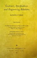
Coutracts, Specifications and Engineering Relations , Third Edition
- Edition
- 3
- ISBN/ISSN
- -
- Collation
- 216 hlm. ; 24 cm.
- Series Title
- -
- Call Number
- 341.3 Mea c
- Edition
- 3
- ISBN/ISSN
- -
- Collation
- 216 hlm. ; 24 cm.
- Series Title
- -
- Call Number
- 341.3 Mea c
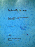
Engineering Hydrology, SECOND EDITION
- Edition
- 2nd
- ISBN/ISSN
- 0-333-17443-7
- Collation
- viii, 364 p.; 24 cm.
- Series Title
- -
- Call Number
- 620.106 Wil e
- Edition
- 2nd
- ISBN/ISSN
- 0-333-17443-7
- Collation
- viii, 364 p.; 24 cm.
- Series Title
- -
- Call Number
- 620.106 Wil e

FUNDAMENTALS OF ENVIRONMENTAL ENGINEERING
- Edition
- -
- ISBN/ISSN
- 0-471-24313-2
- Collation
- xxiii, 680 p. 24 cm
- Series Title
- -
- Call Number
- 628 Mih f
- Edition
- -
- ISBN/ISSN
- 0-471-24313-2
- Collation
- xxiii, 680 p. 24 cm
- Series Title
- -
- Call Number
- 628 Mih f
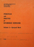
PRINCIPLES and PRACTICE of BITUMINOUS SURFACING Volume 1- Sprayed Work
- Edition
- -
- ISBN/ISSN
- -
- Collation
- 124 p.; 23 cm.
- Series Title
- -
- Call Number
- 660 Pri p
- Edition
- -
- ISBN/ISSN
- -
- Collation
- 124 p.; 23 cm.
- Series Title
- -
- Call Number
- 660 Pri p
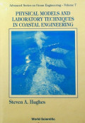
PHYSICAL MODELS AND LABORATORY TECHNIQUES IN COASTAL ENGINEERING
- Edition
- -
- ISBN/ISSN
- 981-02-1541-X
- Collation
- -
- Series Title
- Advanced Series on Ocean Engineering - Volume 7
- Call Number
- 629 Hug p
- Edition
- -
- ISBN/ISSN
- 981-02-1541-X
- Collation
- -
- Series Title
- Advanced Series on Ocean Engineering - Volume 7
- Call Number
- 629 Hug p
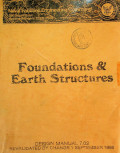
Foundation & Earth Structures
- Edition
- -
- ISBN/ISSN
- -
- Collation
- p. : ill.; 23 cm
- Series Title
- -
- Call Number
- 624.1 Fou f
- Edition
- -
- ISBN/ISSN
- -
- Collation
- p. : ill.; 23 cm
- Series Title
- -
- Call Number
- 624.1 Fou f
THE THEORY OF REINFORCED EMBANKMENTS
- Edition
- -
- ISBN/ISSN
- -
- Collation
- 115 p. : ill. ; 23 cm
- Series Title
- -
- Call Number
- 624.1 Hir t
- Edition
- -
- ISBN/ISSN
- -
- Collation
- 115 p. : ill. ; 23 cm
- Series Title
- -
- Call Number
- 624.1 Hir t
PREFABRICATED VERTICAL DRAINS, Vol. I: Engineering Guideline
- Edition
- -
- ISBN/ISSN
- -
- Collation
- 320 p. : ill. ; 23 cm
- Series Title
- -
- Call Number
- 670 Pre p
- Edition
- -
- ISBN/ISSN
- -
- Collation
- 320 p. : ill. ; 23 cm
- Series Title
- -
- Call Number
- 670 Pre p

Performance of Bituminous and Hydraulic Materials in Pavements
- Edition
- -
- ISBN/ISSN
- -
- Collation
- xiii, 348 p.; 23 cm.
- Series Title
- -
- Call Number
- 660 Zoo p
- Edition
- -
- ISBN/ISSN
- -
- Collation
- xiii, 348 p.; 23 cm.
- Series Title
- -
- Call Number
- 660 Zoo p
SOIL PROPERTIES AND SOIL SAMPLING RELATED TO ENGINEERING GEOLOGY
- Edition
- -
- ISBN/ISSN
- -
- Collation
- p. : ill. ; 23 cm
- Series Title
- -
- Call Number
- 624.15 Hol s
- Edition
- -
- ISBN/ISSN
- -
- Collation
- p. : ill. ; 23 cm
- Series Title
- -
- Call Number
- 624.15 Hol s
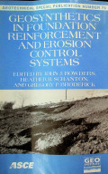
GEOSYNTHETICS IN FOUNDATION REINFORCEMENT AND EROSION CONTROL SYSTEMS
- Edition
- -
- ISBN/ISSN
- -
- Collation
- 147 p.; 24 cm.
- Series Title
- -
- Call Number
- 624.1 Bow g
- Edition
- -
- ISBN/ISSN
- -
- Collation
- 147 p.; 24 cm.
- Series Title
- -
- Call Number
- 624.1 Bow g
DEEP FOUNDATIONS PART 3
- Edition
- 2nd
- ISBN/ISSN
- -
- Collation
- 305 p. : ill. ; 23 cm
- Series Title
- -
- Call Number
- 624.1 Dee d
- Edition
- 2nd
- ISBN/ISSN
- -
- Collation
- 305 p. : ill. ; 23 cm
- Series Title
- -
- Call Number
- 624.1 Dee d

VIBRATIONS OF SOILS AND FOUNDATIONS
- Edition
- -
- ISBN/ISSN
- -
- Collation
- xviii, 414 p.: ill.; 23 cm
- Series Title
- -
- Call Number
- 624.151 Ric v
- Edition
- -
- ISBN/ISSN
- -
- Collation
- xviii, 414 p.: ill.; 23 cm
- Series Title
- -
- Call Number
- 624.151 Ric v
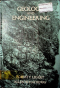
GEOLOGY AND ENGINEERING, THIRD EDITION
- Edition
- 3rd
- ISBN/ISSN
- 0-07-037063-X
- Collation
- xviii, 613 p. : ill. ; 23 cm.
- Series Title
- -
- Call Number
- 624.15 Leg g
- Edition
- 3rd
- ISBN/ISSN
- 0-07-037063-X
- Collation
- xviii, 613 p. : ill. ; 23 cm.
- Series Title
- -
- Call Number
- 624.15 Leg g

AN INTRODUCTION TO ANALYTICAL METHODS IN GEOTECHNICAL ENGINEERING
- Edition
- -
- ISBN/ISSN
- -
- Collation
- 331 p. : ill. ; 26 cm.
- Series Title
- -
- Call Number
- 624.151 Hon i
- Edition
- -
- ISBN/ISSN
- -
- Collation
- 331 p. : ill. ; 26 cm.
- Series Title
- -
- Call Number
- 624.151 Hon i

CONTRACTS AND THE LEGAL ENVIRONMENT for Engineers & Architects, Sixth Edition
- Edition
- 6th
- ISBN/ISSN
- 0-07-039363-X
- Collation
- xxiii, 552 p. ; 24 cm
- Series Title
- -
- Call Number
- 343.73 Boc c
- Edition
- 6th
- ISBN/ISSN
- 0-07-039363-X
- Collation
- xxiii, 552 p. ; 24 cm
- Series Title
- -
- Call Number
- 343.73 Boc c

CONTRACTS AND THE LEGAL ENVIRONMENT: for Engineers & Architects' Sixth Edition
- Edition
- 6
- ISBN/ISSN
- 0-07039363-X
- Collation
- xiii, 552 p. ; 25 cm
- Series Title
- -
- Call Number
- 343.7307 Boc c
- Edition
- 6
- ISBN/ISSN
- 0-07039363-X
- Collation
- xiii, 552 p. ; 25 cm
- Series Title
- -
- Call Number
- 343.7307 Boc c
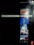
ENGINEERING GEOLOGY, SECOND EDITION
- Edition
- 2nd
- ISBN/ISSN
- 978-7506-8077-6
- Collation
- ix, 581 p. ; tab. ; ill.; 26 cm
- Series Title
- -
- Call Number
- 551 Bel e
- Edition
- 2nd
- ISBN/ISSN
- 978-7506-8077-6
- Collation
- ix, 581 p. ; tab. ; ill.; 26 cm
- Series Title
- -
- Call Number
- 551 Bel e

Information Technology in Environmental Engineering : Selected Contributions …
Information technologies have evolved to an enabling science for natural resource management and conservation, environmental engineering, scientific simulation and integrated assessment studies. Co…
- Edition
- 1
- ISBN/ISSN
- 978-3-642-36011-4
- Collation
- viii, 228 hlm
- Series Title
- -
- Call Number
- 620 FUN i
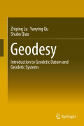
Geodesy: Introduction to Geodetic Datum and Geodetic Systems
Geodetic datum (including coordinate datum, height datum, depth datum, gravimetry datum) and geodetic systems (including geodetic coordinate system, plane coordinate system, height system, gravimet…
- Edition
- 1
- ISBN/ISSN
- 978-3-642-41245-5
- Collation
- xxi, 401 hlm
- Series Title
- -
- Call Number
- 526.1 LUZ g

The Near-Surface Layer of the Ocean: Structure, Dynamics and Applications
The rationale for publishing a second edition of this monograph is that this area of research continues to show remarkable advancement. The new generation of synthetic aperture radar satellites pro…
- Edition
- 2
- ISBN/ISSN
- 978-94-007-7621-0
- Collation
- xxviii, 552 hlm
- Series Title
- Atmospheric and Oceanographic Sciences Library
- Call Number
- 551.46 SOL e
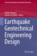
Earthquake Geotechnical Engineering Design
Pseudo-static analysis is still the most-used method to assess the stability of geotechnical systems that are exposed to earthquake forces. However, this method does not provide any information abo…
- Edition
- 1
- ISBN/ISSN
- 978-3-319-03182-8
- Collation
- XII, 388 hlm
- Series Title
- Geotechnical, Geological and Earthquake Engineering
- Call Number
- 624.15 MAU e

Engineering Geology for Society and Territory - Volume 7: Education, Professi…
This book is one out of 8 IAEG XII Congress volumes, and deals with education and the professional ethics, which scientists, regulators, and practitioners of engineering geology inevitably have to …
- Edition
- 1
- ISBN/ISSN
- 978-3-319-09303-1
- Collation
- xv, 274 hlm
- Series Title
- -
- Call Number
- 624.13 LOL e
Engineering Geology for Society and Territory - Volume 4: Marine and Coastal…
This book is one out of 8 IAEG XII Congress volumes, and deals with the processes occurring on the coastal zone, which represents a critical interface between land and sea, as the contribution of t…
- Edition
- 1
- ISBN/ISSN
- 978-3-319-08660-6
- Collation
- xiii, 235 hlm
- Series Title
- -
- Call Number
- 624.1 LOL e
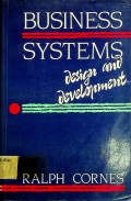
BUSINESS SYSTEMS : Design and Development
- Edition
- -
- ISBN/ISSN
- 0-13-880832-5
- Collation
- xiii, 199 p. ; 24 cm
- Series Title
- -
- Call Number
- 658.4 Cor b
- Edition
- -
- ISBN/ISSN
- 0-13-880832-5
- Collation
- xiii, 199 p. ; 24 cm
- Series Title
- -
- Call Number
- 658.4 Cor b

MANAGEMENT AS A NEW TECHNOLOGY
- Edition
- -
- ISBN/ISSN
- 0-07-002988-1
- Collation
- xxii, 422 p. : ill. ; 23 cm
- Series Title
- -
- Call Number
- 658 Bad m
- Edition
- -
- ISBN/ISSN
- 0-07-002988-1
- Collation
- xxii, 422 p. : ill. ; 23 cm
- Series Title
- -
- Call Number
- 658 Bad m

GRADUATE RECORD EXAMINATION (GRE) ENGINEERING
- Edition
- -
- ISBN/ISSN
- 0-12-363573-2
- Collation
- 150 p.;ill.;23 cm
- Series Title
- -
- Call Number
- 620.007 Cat g
- Edition
- -
- ISBN/ISSN
- 0-12-363573-2
- Collation
- 150 p.;ill.;23 cm
- Series Title
- -
- Call Number
- 620.007 Cat g
TRANSPORTATION ENGINEERING : PLANNING AND DESIGN
- Edition
- -
- ISBN/ISSN
- -
- Collation
- vi, 760 p.; tab.; 23 cm.
- Series Title
- -
- Call Number
- 629.04 Paq t
- Edition
- -
- ISBN/ISSN
- -
- Collation
- vi, 760 p.; tab.; 23 cm.
- Series Title
- -
- Call Number
- 629.04 Paq t
HUMAN FACTORS IN ENGINEERING AND DESIGN T M H EDITION
-
- Edition
- -
- ISBN/ISSN
- -
- Collation
- ix, 790p.;24cm
- Series Title
- -
- Call Number
- 620.8 Mcc h
ECONOMIC ANALYSIS FOR ENGINEERING AND MANAGERIAL DECISION MAKING, Second Edition
- Edition
- 2
- ISBN/ISSN
- 0-07-003649-7
- Collation
- x, 789 p. : ill ; 23 cm
- Series Title
- -
- Call Number
- 330 Bar e
- Edition
- 2
- ISBN/ISSN
- 0-07-003649-7
- Collation
- x, 789 p. : ill ; 23 cm
- Series Title
- -
- Call Number
- 330 Bar e



 Computer Science, Information & General Works
  Philosophy & Psychology
  Religion
  Social Sciences
  Language
  Pure Science
  Applied Sciences
  Art & Recreation
  Literature
  History & Geography